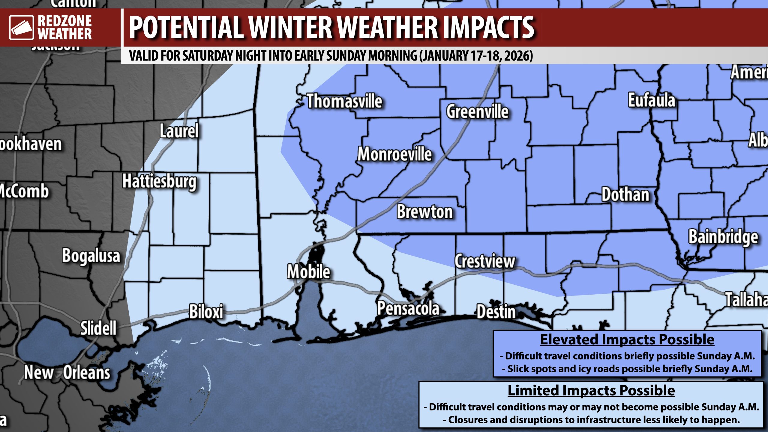
UPDATE ON RAIN/SNOW PROJECTION FOR SATURDAY NIGHT INTO EARLY SUNDAY… Snow totals across the region will VERY likely be less than 0.75″ in nearly all cases, outside of a few surprises. Most spots will have a dusting and that’s about it, based on the latest 3PM data on Thursday, January 15, 2026.
Temperatures will rapidly rise above the freezing mark around 8-9AM Sunday, paving the way for rapidly melting snow and improving road conditions. This won’t be anything like the multi-day blizzard we had in January 2025 – nothing close to that, most likely.
I am working up another detailed evening update that will be posted in the 8-9PM hour. See you then!
