11:45AM January 3, 2026
Pretty good rain and thunder occurring near Bratt. @rzweather
.10” in the last few minutes. .16” since last evening.— 1775 or 1860? (@ScobieSr) January 3, 2026

Pretty good rain and thunder occurring near Bratt. @rzweather
.10” in the last few minutes. .16” since last evening.— 1775 or 1860? (@ScobieSr) January 3, 2026
Showers and thunderstorms are developing late this morning near Georgetown, Bay Minette, Atmore, Bratt, and Poarch. These storms are drifting east. Showers are also happening near Brewton, Roberts, Rome, and Gantt. pic.twitter.com/Vu91qg17vs
— Spinks Megginson (@rzweather) January 3, 2026

Showers happening near Pensacola, Navarre, Destin, Dauphin Island, Fort Walton Beach, and Niceville continue to move east this morning.
Not seeing any signs of severe weather issues locally, as of 8:20AM. pic.twitter.com/UKAVNrg6F6
— Spinks Megginson (@rzweather) January 3, 2026

Rain continues near Niceville, Destin, Navarre, Fort Walton Beach. Developing showers in Baldwin County, AL are moving toward Pensacola.
Storms are below severe limits as of 7:25AM. pic.twitter.com/4xtDkgjD1M
— Spinks Megginson (@rzweather) January 3, 2026

SPOTTY SHOWERS & STORMS TODAY; LOW-END SEVERE WEATHER RISK… Scattered showers and thunderstorms will be possible throughout the day and into this evening. Some of the storms, particularly storms that develop along, south, and east of Interstate 65, may be briefly strong or severe.
The main hazards of concern today will be gusty winds and large hail in the strongest of the storms. The overall tornado risk remains low, but not entirely zero. We encourage everyone to have a way to hear warnings just in case hazards happen across the local area.
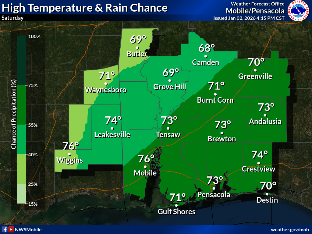
High temperatures will be in the low 70s today.
Have a great Saturday!

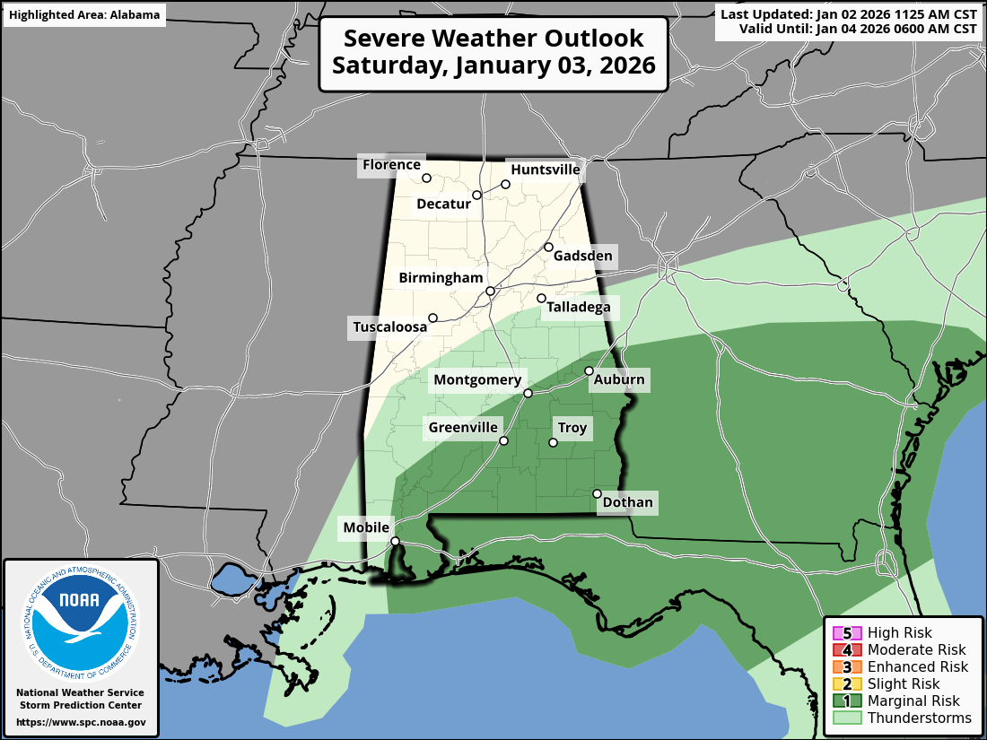
LOW-END SEVERE WEATHER RISK TODAY… Isolated strong to severe storms may become possible today into this evening, specifically in areas along, south, and east of I-65 where the risk is greatest. Still a LOW-END risk for all of northwest Florida and much of southwest Alabama.
A tornado or two, gusty winds, large hail possible in the strongest of the storms today.

Spotty showers are increasing in coverage across the region on this Saturday morning. Some thunder may be possible over the next few hours. Thunderstorm coverage will increase after sunrise.
Storms will likely remain scattered in nature. Severe weather risk ramps up slightly… pic.twitter.com/uUdUmsxLD1
— Spinks Megginson (@rzweather) January 3, 2026
