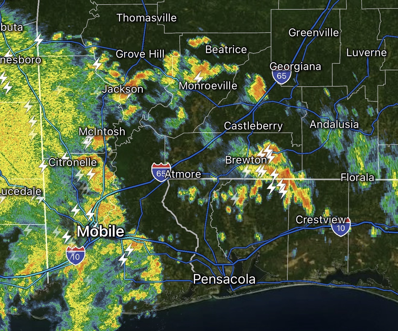
2:39PM May 28, 2026
Storms are happening near Brewton, AL this afternoon. Thanks to Sabrina McCall for the view from near Georgia Pacific paper mill. https://t.co/E5VihFGlXC
— Spinks Megginson (@rzweather) May 28, 2026
2:01PM May 28, 2026
Spotty thunderstorms continue to increase in coverage this afternoon across south Alabama and northwest Florida.
Heavier, more consistent rain is spreading into Mobile County from the southwest as of 2:01PM. https://t.co/ZQLdOVcKPe
— Spinks Megginson (@rzweather) May 28, 2026
1:50PM May 28, 2026
RT @britttg_94: Looking rough in Atmore. ☁️
@NWSMobile @spann @AlabamaWXNet @rzweather @KNBHwx @ThomasGeboyWX @WKRGEd @textamet #ALwx htt…
— Spinks Megginson (@rzweather) May 28, 2026
12:46PM May 28, 2026
Thunderstorms continue to spread inland this afternoon near Appleton, Roberts, Bethel, Walnut Hill, Booneville, McCullough, Deer Park, Citronelle, Semmes, Mauvila, and Stockton.
We need to watch this surge of wind/storms in Jackson County, MS just north of Pascagoula. That will https://t.co/EC9TGuPdzh
— Spinks Megginson (@rzweather) May 28, 2026
12:26PM May 28, 2026
Drought Monitor – Last Week vs. This Week
MAJOR improvements across Alabama, northwest Florida, and the Deep South! https://t.co/l1XZsudx0c
— Spinks Megginson (@rzweather) May 28, 2026
11:52AM May 28, 2026
Scattered thunderstorms are quickly developing at midday near Flomaton, Brewton, Atmore, Century, Crestview, Baker, Bay Minette, Walnut Hill, and Robertsdale.
More pop-up storms are likely to develop this afternoon into this evening. Be ready for scattered downpours! https://t.co/WIUvl4guo9
— Spinks Megginson (@rzweather) May 28, 2026


