
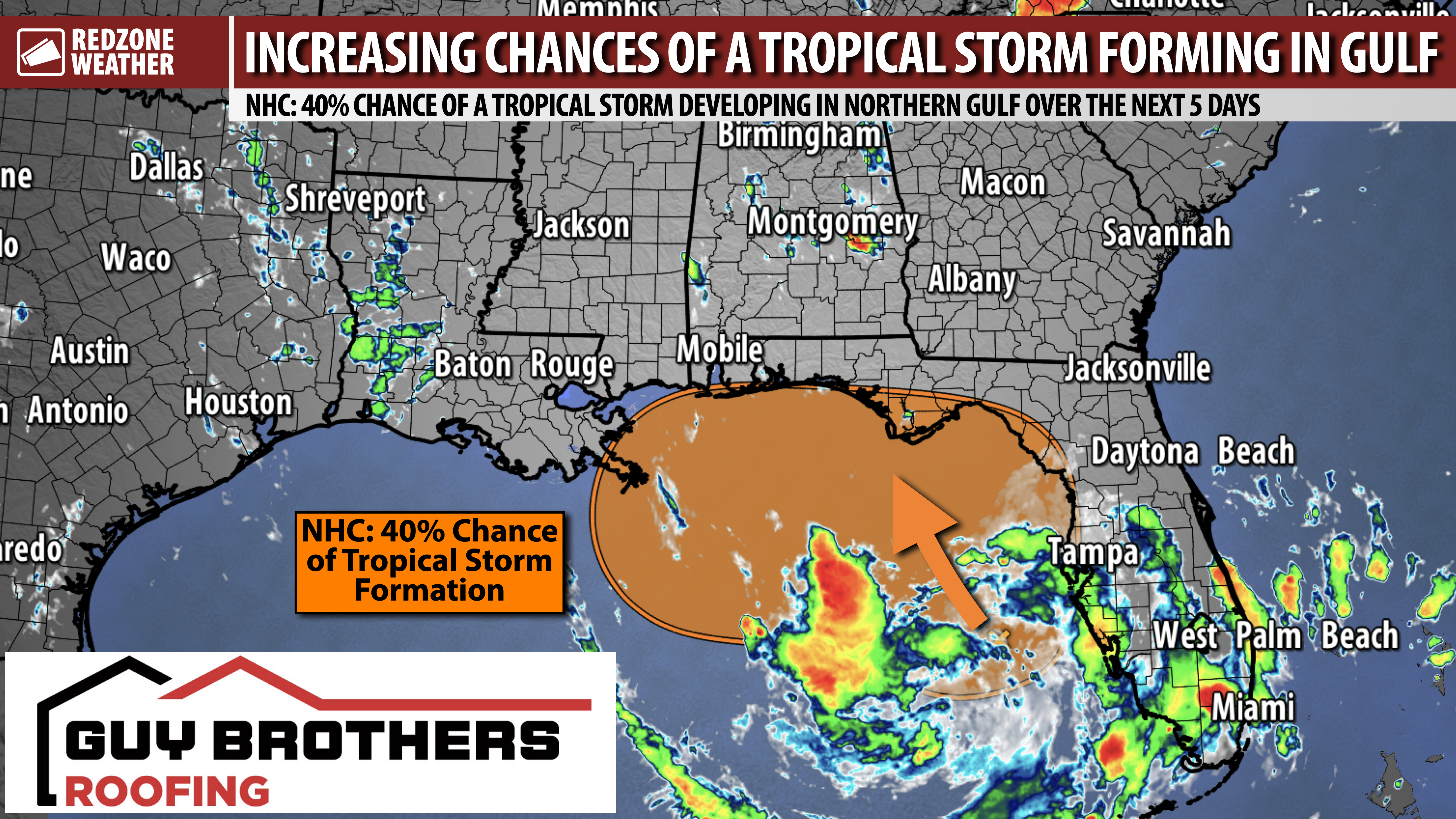
TROPICAL DEVELOPMENT BECOMING MORE LIKELY IN NORTHERN GULF… The odds of a tropical storm developing in the northern Gulf continue to increase on this Saturday. The National Hurricane Center now has a 40% chance of a tropical storm developing in the northern Gulf into early next week. The vast majority of the major global weather models I have seen today seem to keep the system rather weak and disorganized. The trend over the last 24 hours supports the system meandering in the northern Gulf into the early part of the upcoming week. This points to increased rain chances, depending on exactly where the center of the system moves. It is impossible to know where this system will ultimately end up, but the trends now support the system drifting north toward the Florida Panhandle. Thankfully, impacts look to be rather limited at this point.
BLUE ANGELS AIR SHOW FORECAST – THIS AFTERNOON… No changes to the forecast for the annual Blue Angels Air Show at Pensacola Beach today. We have a mix of sunshine and clouds in progress. Isolated showers and thunderstorms have started popping up across south Alabama and northwest Florida. I have been and will continue to post radar updates in the RedZone Weather app. Be aware, particularly if you’re out on the beach or out on the water in a boat, scattered thunderstorms will be possible over the next few hours. Cloud-to-ground lightning will be a concern. Be able to get indoors quickly. Thankfully, severe weather and tornadoes are not in the forecast today. This is a classic summer day where storms develop quickly and fade fairly quickly.
SLOW-MOVING TROPICAL SYSTEM POSSIBLE IN NORTHERN GULF… The odds of a named tropical storm developing in the northern Gulf have increased. This may end up being a setup where we see a slow-moving disturbance, tropical depression, or tropical storm that goes nowhere very quickly. This would point to the potential for quite a bit of rain for parts of Florida in the days ahead, specifically in areas along and east of the center of circulation. Many question marks remain as to who will receive impacts from this system and where it will ultimately end up. Right now, we’re at the phase where we’re simply seeing trends that support more in the way of a named tropical storm developing, but beyond that, many of the details remain murky. I suspect we will gain clarity in the days ahead as we ingest more model data. Please make sure you check back in for updates!
SIGNIFICANT IMPACTS APPEAR UNLIKELY LOCALLY… Odds of a hurricane impacting south Alabama and northwest Florida remain very, very low. This looks more like a “rain at times” setup than anything else. If I had a beach trip planned this week, would I cancel? Nope. There may be a few days with increased rain chances, but later this week will be drier. No reason to panic or worry over this system – just be aware we may have a tropical storm developing in the northern Gulf and gradually drifting toward the coast in the days ahead.
HIGH RISK OF RIP CURRENTS… The overall risk of dangerous rip currents is expected to increase this weekend into early next week at all beaches along the northern Gulf Coast and along the west coast of Florida in the days ahead. We lose far too many beachgoers each year to rip currents! It’s a totally preventable cause of death. Please stay out of the water at the beaches if red flags are flying.
APP… If you haven’t already downloaded the RedZone Weather app, now is a great time to do that. redzoneweather.com/app is the link to the free download. Once you have the RZW app installed on your iOS or Android device, be sure to visit the Alerts tab to turn on the specific notifications you’d like to receive. All notifications are handcrafted by me. No automation and we promise not to bug you!
I will have more updates posted this weekend in the RedZone Weather app.
Have a nice Saturday!
