
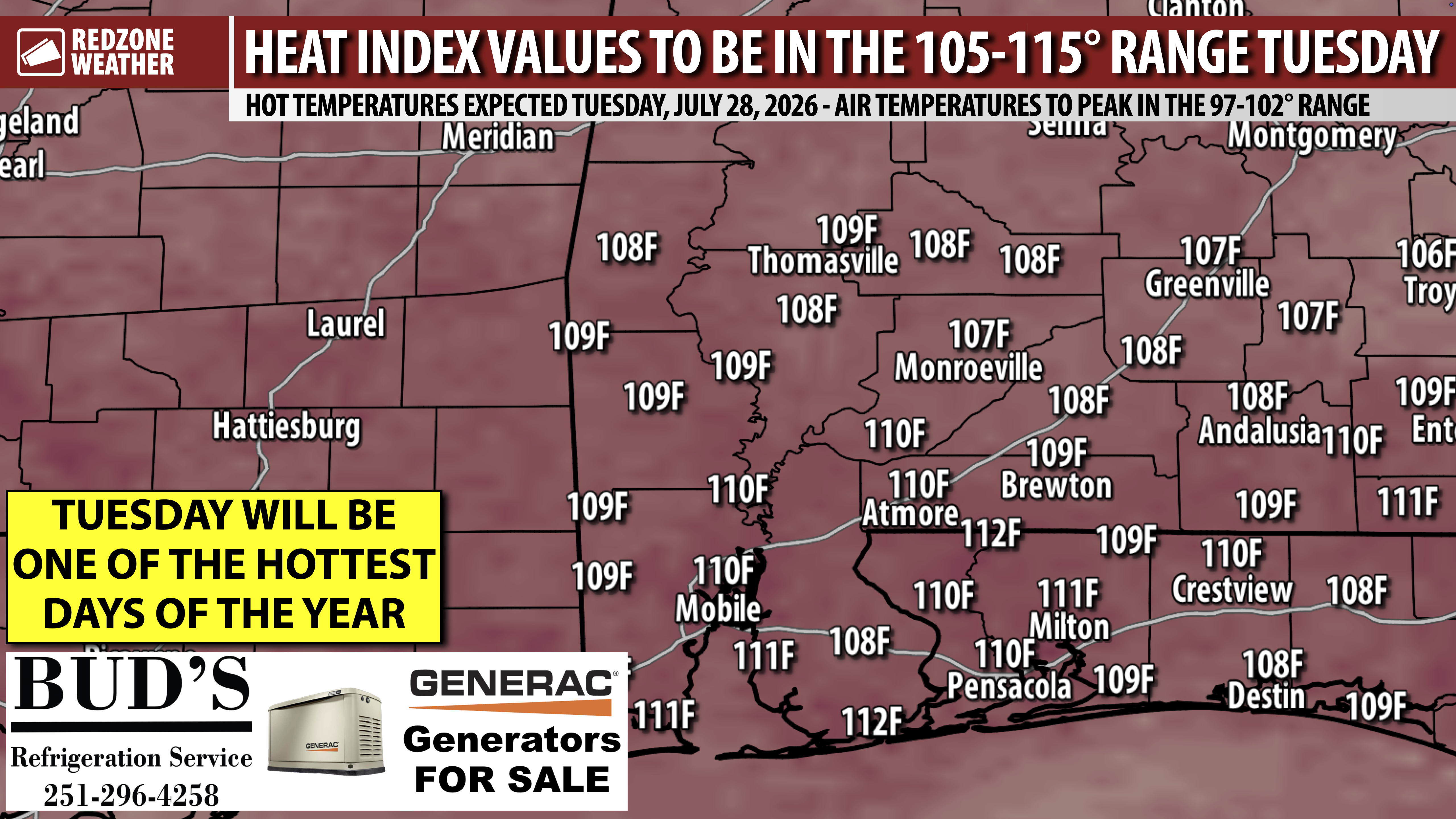
VERY HOT & HUMID TUESDAY; EXCESSIVE HEAT WARNING… Tomorrow (Tuesday, July 28) very well may be the hottest day of the year across south Alabama and northwest Florida. Air temperatures will be near the 100 degree mark with heat index values in excess of 110° in many communities. Our local area is on the eastern side of a large ridge of high pressure, keeping much of the nation baking with excessive temperatures. Tuesday will be the hottest day in many communities across the Deep South ahead of slightly more normal summer heat returning later this week and into the weekend.
HEAT ALERTS FOR ALL OF ALABAMA & N.W. FLORIDA… An Excessive Heat Warning is in effect for all coastal communities near the beaches and bays. Everyone else across the region and northward into Alabama has a Heat Advisory in effect for Tuesday. Regardless of if you’re involved with the warning or advisory, extreme heat is expected region wide.
SPOTTY STORMS POSSIBLE TUESDAY… Just like what happened today, isolated showers and thunderstorms will be possible across the region. I expect MOST communities to remain completely dry and hot tomorrow. If you’re under one of the storms, count yourself as blessed as that should help to cool temperatures down by 10-20 degrees, depending on how long rainfall lasts. Rain chances will likely rise as we get into the upcoming weekend.
TROPICS: ATLANTIC BASIN QUIET… After Tropical Storm Bertha last week, we’re now back in a quiet period in the Atlantic Basin (including the Gulf and Caribbean Sea) with no tropical storms expected to form over the next 5-7 days. Seasonal outlooks consistently have suggested that the Atlantic Basin may have a below normal year, in terms of the number of tropical storms and hurricanes that form. We’re in a very strong El Niño pattern that typically suppresses hurricane activity in the Atlantic Basin. It only takes one storm to make it a memorable year, however. I’ll be monitoring trends, particularly as we get into the three most active months of the hurricane season in August, September, and October. For now, we’re good with no significant tropical activity expected in the days ahead.
APP… If you haven’t already downloaded the RedZone Weather app, now is a great time to do that. redzoneweather.com/app is the link to the free download. Once you have the RZW app installed on your iOS or Android device, be sure to visit the Alerts tab to turn on the specific notifications you’d like to receive. All notifications are handcrafted by me. No automation and we promise not to bug you!
I will have the next detailed RedZone Weather forecast video posted by 7:15AM tomorrow morning.
Have a great Monday evening!
