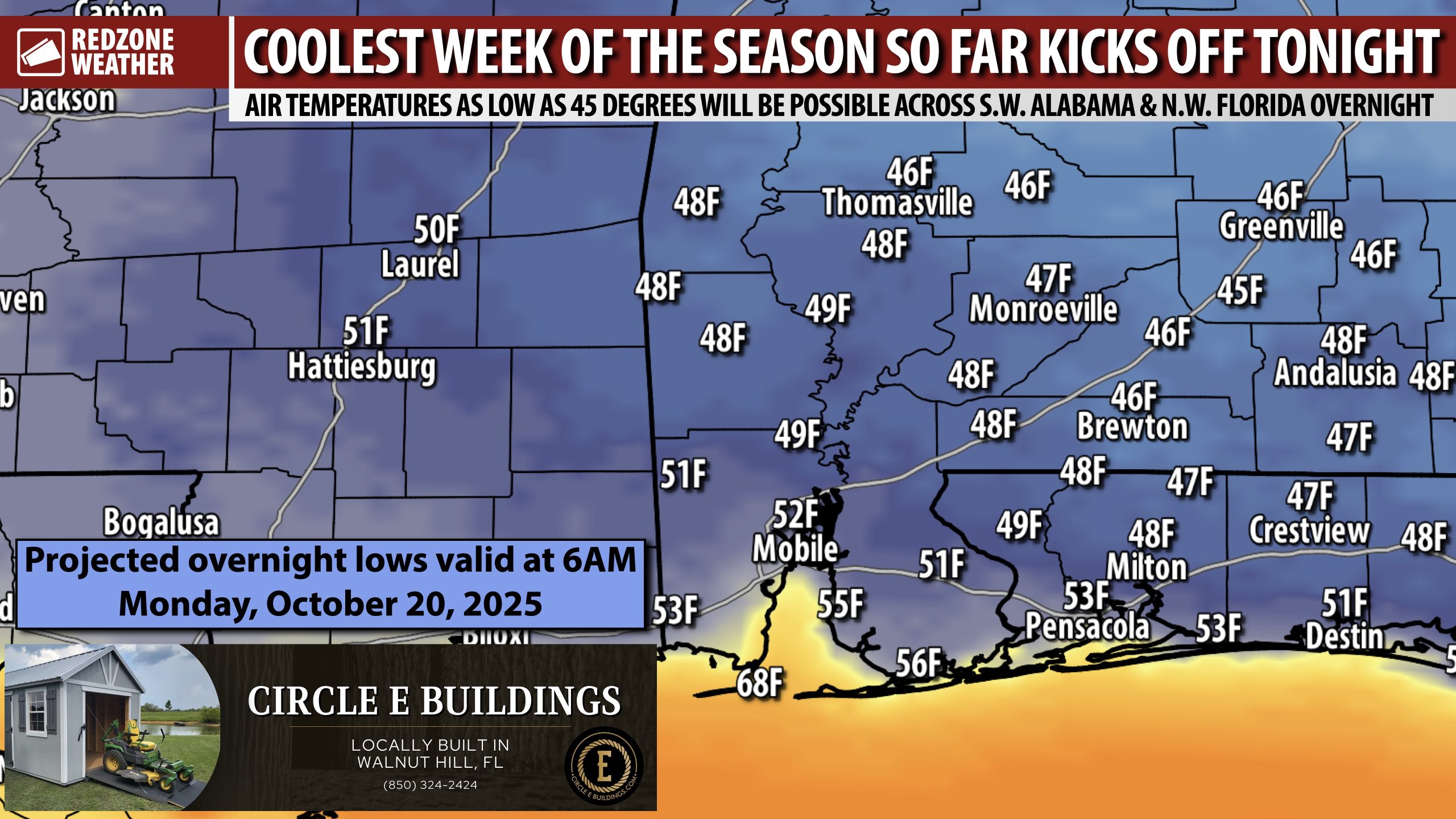
FALL TEMPERATURES ARRIVE THIS WEEK; LOWS IN THE 40s… After the storms earlier today, we have a streak of beautiful, fall days coming up now that a cold front has moved across the region. Overnight lows at 6AM on Monday morning will be in the 40s in many spots with 50s likely closer to the coast. See the attached map for the specific overnight low you can expect in your hometown. Afternoon highs will be in the upper 70s and low 80s tomorrow.
TROPICAL WAVE IN CARIBBEAN SEA LIKELY TO DEVELOP INTO TROPICAL STORM… A tropical wave currently moving through the Lesser Antilles has a high (70%) chance of becoming a named tropical storm later this week as the system moves through the very warm waters of the Caribbean Sea. Environmental conditions are highly favorable for a tropical storm to develop. The model guidance associated with the system shows movement to the north, potentially toward Puerto Rico, Hispaniola, or Cuba later this week. The odds of the system moving into the Gulf currently seem quite low.
APP… If you haven’t already downloaded the RedZone Weather app, now is a great time to do that. redzoneweather.com/app is the link to the free download. Once you have the RZW app installed on your iOS or Android device, be sure to visit the Alerts tab to turn on the specific notifications you’d like to receive. All notifications are handcrafted by me. No automation and we promise not to bug you!
Join us tomorrow morning in the next regularly scheduled RedZone Weather forecast video that will be posted by 7:15AM for the latest information.
Have a good Sunday evening!
