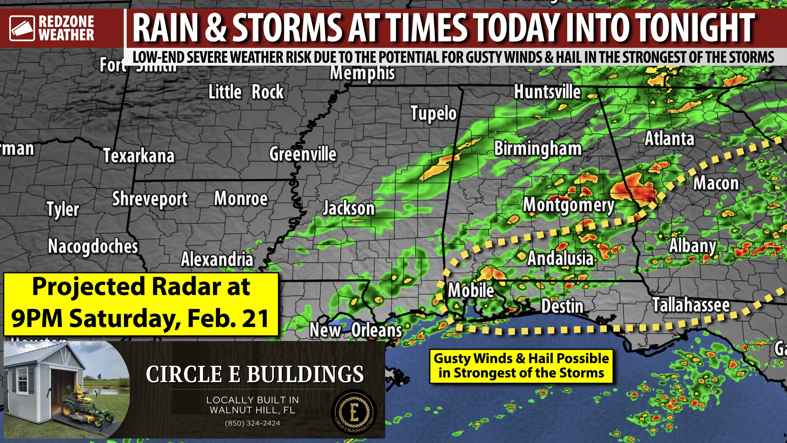
SCATTERED STORMS THRU TONIGHT; GUSTY WINDS POSSIBLE IN STRONGEST OF THE STORMS… Scattered thunderstorms will be possible at times on this Saturday and into this evening. It will not rain all day in any given community, but we will have storms around at times most likely. Widespread, significant severe thunderstorms are not expected today or tonight, but one or two isolated strong to marginally severe thunderstorms can’t completely be ruled out. The main concerns in any thunderstorms that become strong today will be the potential for gusty winds and hail up to quarter size. The overall tornado risk remains quite low. We will likely see a broken line of thunderstorms move from northwest to southeast across the region this evening between 4PM and 10PM. Much cooler, drier air arrives overnight into Sunday.
QUICK COOLDOWN STARTS TONIGHT; HIGHS IN 50s MONDAY AND TUESDAY… Winter is set to make its temporary comeback starting tonight and into tomorrow. Lows will be in the 40s by 6AM Sunday with highs only in the 50s tomorrow. Most communities will start the day around the freezing mark on Monday morning with highs on Monday projected to be in the low 50s. Monday night into Tuesday is when we could have a 7-8 hour interval with below freezing temperatures. Lows will be in the mid 20s by 6AM Tuesday. Temperatures quickly rebound on Wednesday into Thursday of the upcoming week. Highs will be in the mid 70s by Thursday.
The odds of any tornado warnings across south Alabama and northwest Florida are quite low today, but perhaps not entirely zero. I will be in and out of the studio throughout the day posting updates, as needed. IF we happen to have a tornado warning today or this evening, be sure to join me in live streaming video coverage.
Have a great Saturday!
