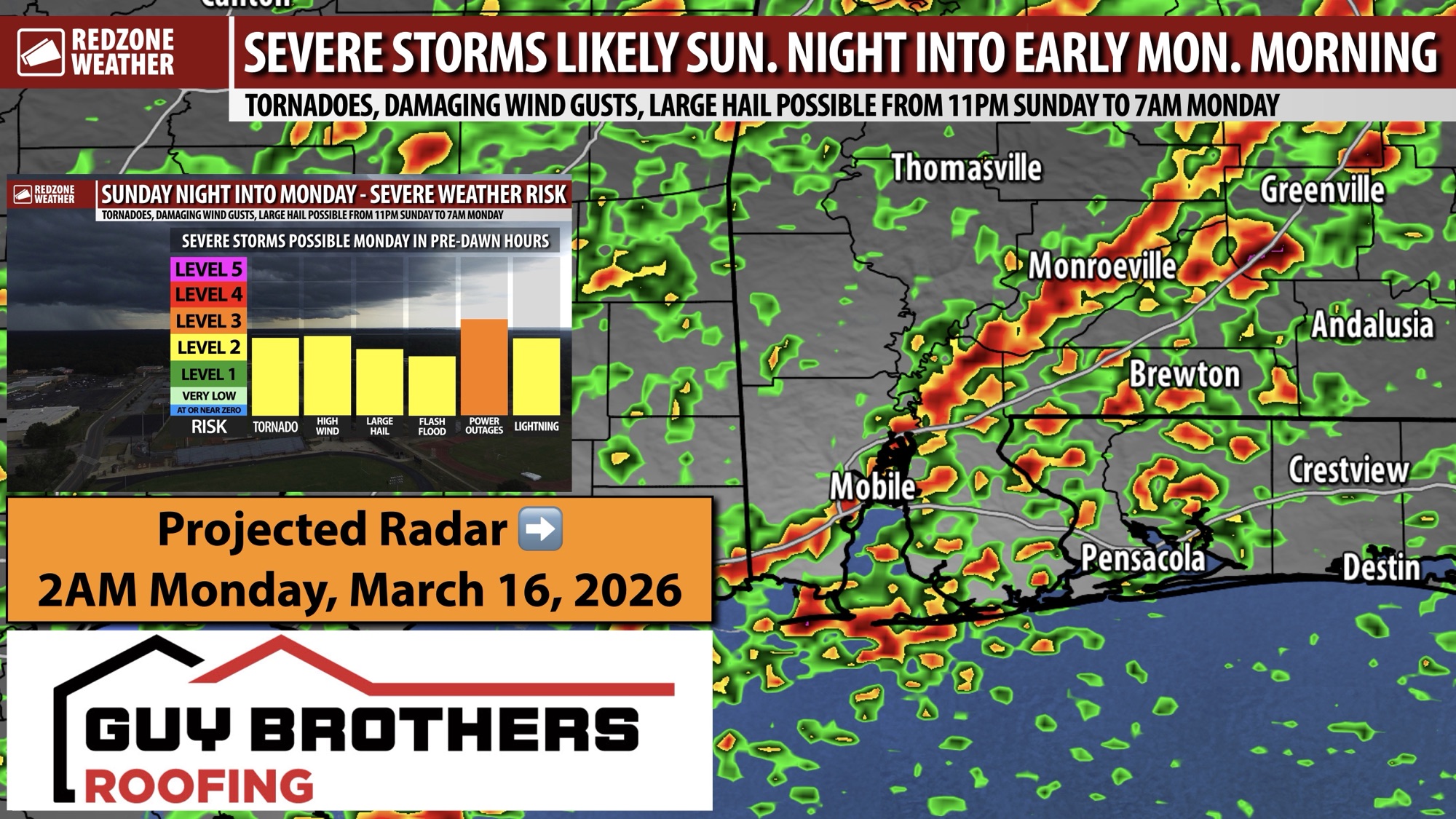
STORMS LIKELY TO BE STRENGTHENING ON APPROACH SUNDAY NIGHT… The risk of tornadoes and damaging wind gusts has increased slightly across south Alabama and northwest Florida valid for Sunday night into early Monday morning. The current expectations are for a rather thin, but potent, line of strong to severe storms to move from west to east rapidly across the region from 11PM Sunday night to 7AM. There is a conditional risk of a few supercell storms out ahead of the line of storms as well.
The overall tornado risk may be a bit more pronounced, particularly along, south, and east of Interstate 65.
Tornadoes, damaging wind gusts, and large hail will be possible. As always, if/when we have tornado warnings across southwest Alabama and northwest Florida, we will be in uninterrupted, live video coverage with the latest details.
I’ll have much more details on this event tomorrow. Have a good Saturday evening!
