6:29AM November 22, 2025
WARM TEMPERATURES TODAY… Fog is quite dense in spots this morning. Take it slow if driving.
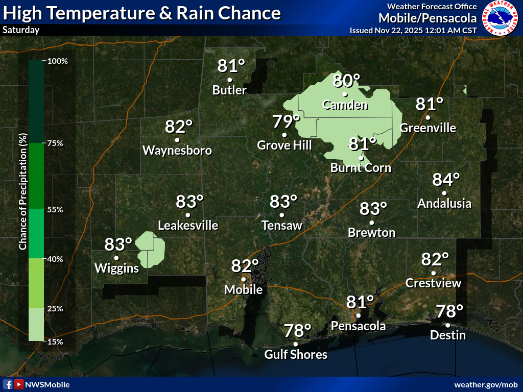
Isolated showers will be possible on this Saturday. Most communities will remain dry.
High temperatures will be in the low 80s today.
Have a great Saturday!


