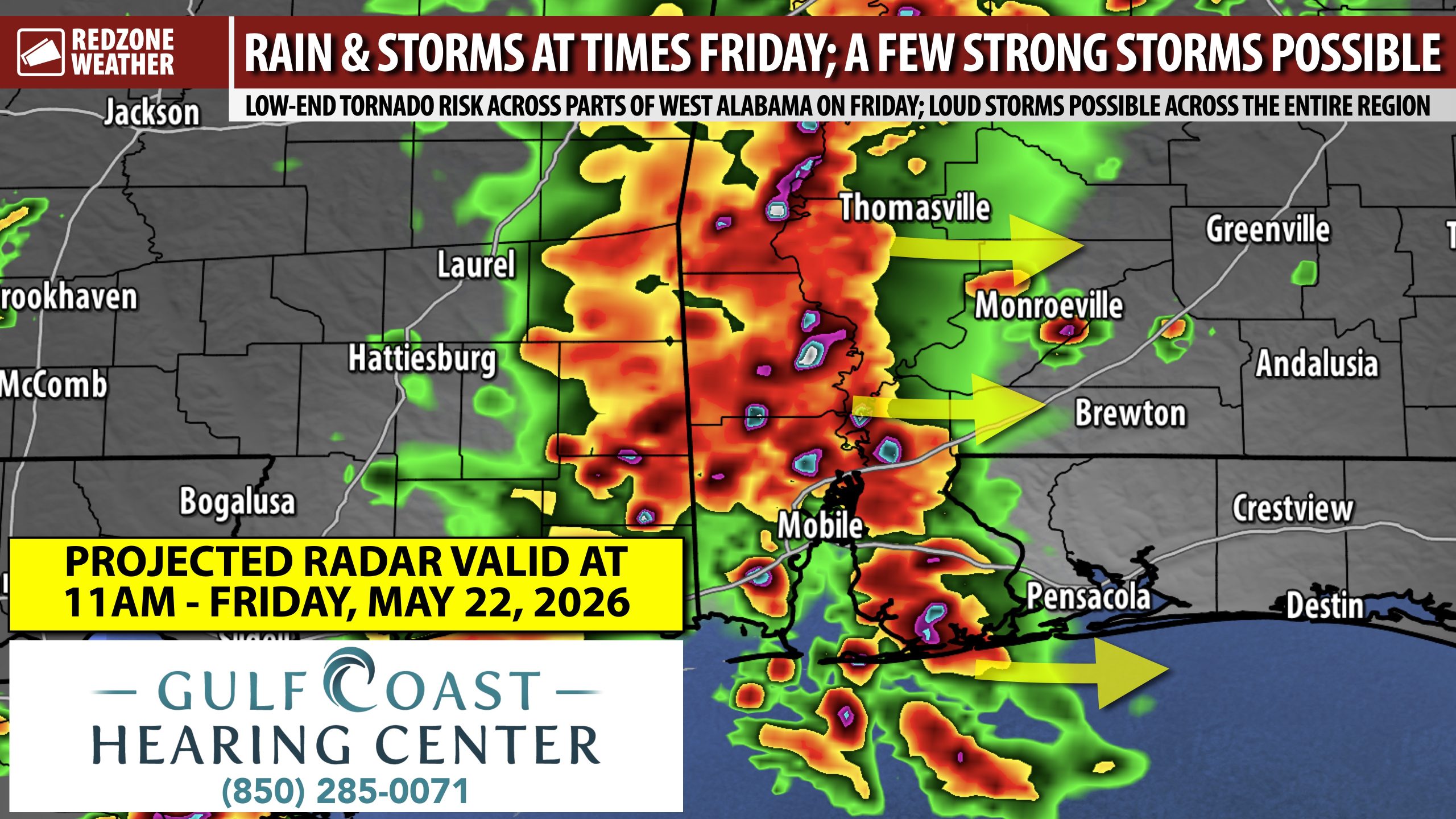
SPOTTY SEVERE STORMS POSSIBLE FRIDAY; RAIN & THUNDER FOR MOST LOCALES… Rain and thunderstorms will be possible across south Alabama and northwest Florida on Friday. The Storm Prediction Center has introduced a low-end, Level 1 (out of 5) severe weather risk for areas west of the Alabama River on Friday. This severe weather risk will likely set up mainly in the late morning and afternoon hours. The concern is that thunderstorms will be moving through when the environment could support a few “miniature supercells” (or “mini spinnys” as our local National Weather Service office calls them!). More often than not, these thunderstorms don’t produce tornadoes, however, every once in awhile you’ll get a few of these storms that do produce a tornado or two. This means the overall risk Friday isn’t particularly high, but it’s notable enough to mention so you will be aware of the risk.
SEVERE WEATHER TIMING – FRIDAY… Friday is set to be a low-end severe weather risk day, mainly across west Alabama. 7AM to 4PM is the main window for any severe storms on Friday. To be clear, most communities will simply have rain and thunder at times. Some communities, particularly in northwest Florida, won’t get much rain at all most likely as storms are expected to be spotty in nature.
POP-UP STORMS ON SATURDAY… I expect Saturday to be a more traditional summertime pattern across the local area with pop-up thunderstorms being the norm. I have had so many questions over the last few days from folks worried about their weekend plans for the Memorial Day holiday weekend. I do NOT suggest cancelling plans at this point. The fact is, it is so typical for our region to have occasional pop-up thunderstorms in the early summer months. This is totally normal for this time of year. There inevitably will be some sunshine each day. Widespread, significant severe storms are not in the forecast over the next 7 days locally. Loud storms that produce heavy rain may be possible in some locales, but big time tornadoes are not expected.
TORNADO WARNING POLICY… Any time there is an active tornado warning in effect for southwest Alabama or northwest Florida, we provide uninterrupted, live video coverage on Facebook Live and YouTube Live. Our detailed coverage commitment is outlined at redzoneweather.com/coverage. We are proud to cover all parts of Escambia (AL), Covington, Monroe, Conecuh, Baldwin, Mobile, Clarke, Washington (AL), Butler, Escambia (FL), Santa Rosa, and Okaloosa counties. If you live in any locale in those counties, be sure to tune into our coverage whenever there is an active tornado warning!
APP ALERTS… redzoneweather.com/app is the link where you can download the free RedZone Weather app. We post brief updates throughout each day in the app, keeping you up-to-date about the latest happenings in weather across south Alabama and northwest Florida. Once you have the free app downloaded to your iOS or Android device, be sure to visit the Alerts tab (lower right corner) then tap the large Alert Settings button to customize the alerts you would like to receive straight from me.
I will have a full forecast rundown posted in the next regularly scheduled RedZone Weather forecast video that will be posted by 7:15AM tomorrow morning.
Have a great Thursday evening!