6:28AM January 1, 2026
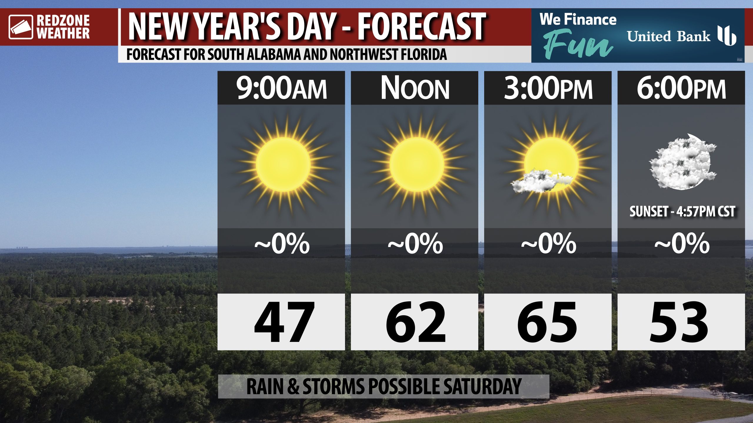
MAINLY SUNNY FOR NEW YEAR’S DAY… Happy New Year! I hope your 2026 is your best year yet.
Mostly sunny skies this morning will give way to increasingly cloudy skies this evening after sunset. Afternoon highs will be in the mid 60s.
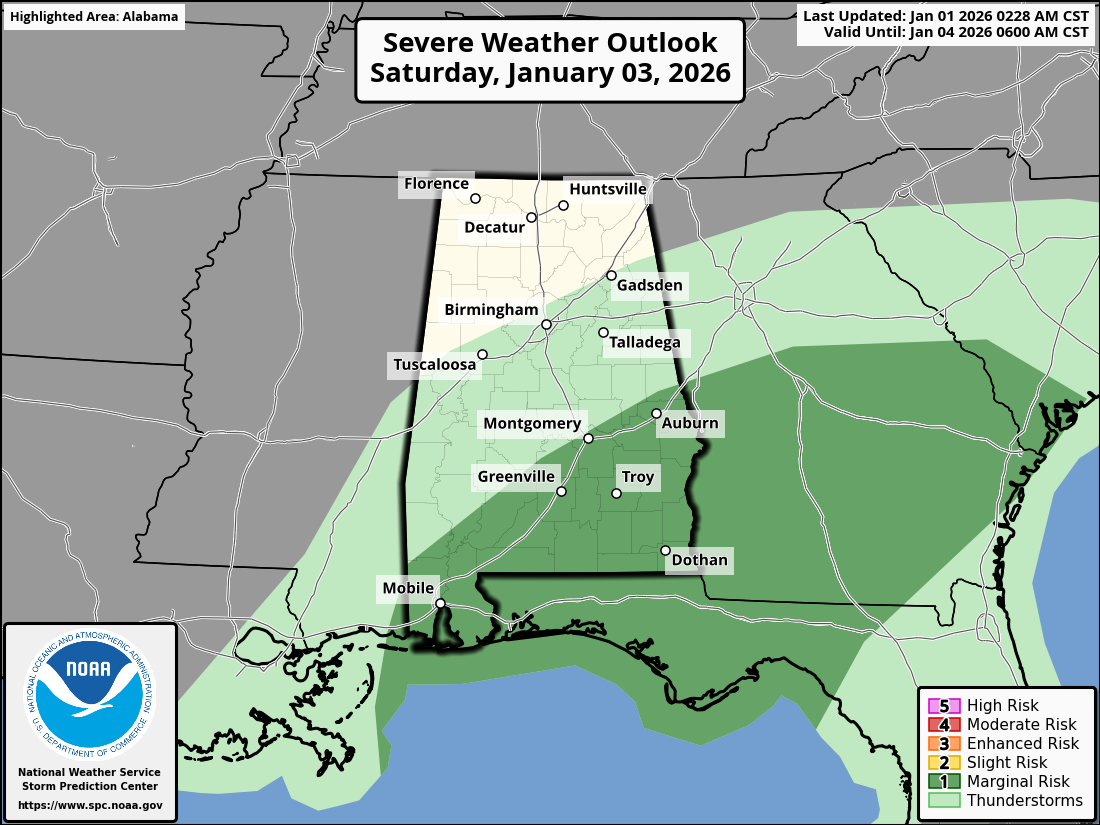
Have a wonderful New Year’s Day!