1:28PM January 1, 2026
Warmer today, with temperatures expected to top out in the mid to upper 60s. pic.twitter.com/z56vVA7nGD
— NWS Mobile (@NWSMobile) January 1, 2026

Warmer today, with temperatures expected to top out in the mid to upper 60s. pic.twitter.com/z56vVA7nGD
— NWS Mobile (@NWSMobile) January 1, 2026
Beautiful New Year's Day in progress across Alabama and northwest Florida!
Temperatures are in the 50s and 60s across south Alabama and northwest Florida. We're headed to the mid to upper 60s for afternoon highs.
No rain today but rain becomes possible at times on Friday into… pic.twitter.com/H6aSwEXrg3
— Spinks Megginson (@rzweather) January 1, 2026

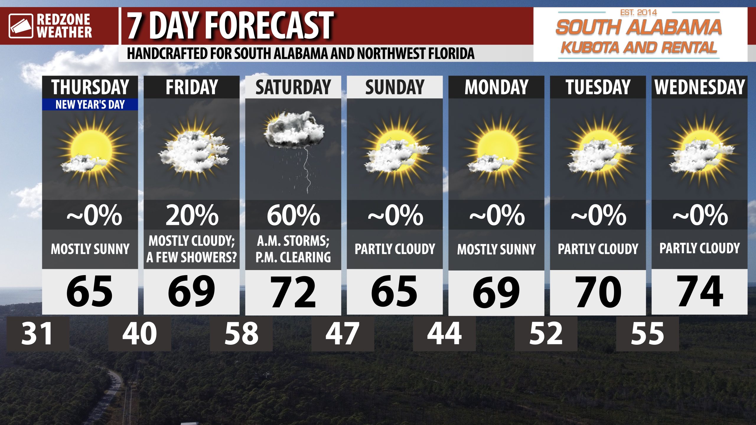
RAIN & STORMS POSSIBLE AT TIMES SATURDAY… Scattered showers and thunderstorms will be possible late Friday night into Saturday. Isolated strong storms may become possible with gusty winds being the primary concern.
Next week looks increasingly mild and nice. Afternoon highs will be around the 70 degree mark on Monday and Tuesday.

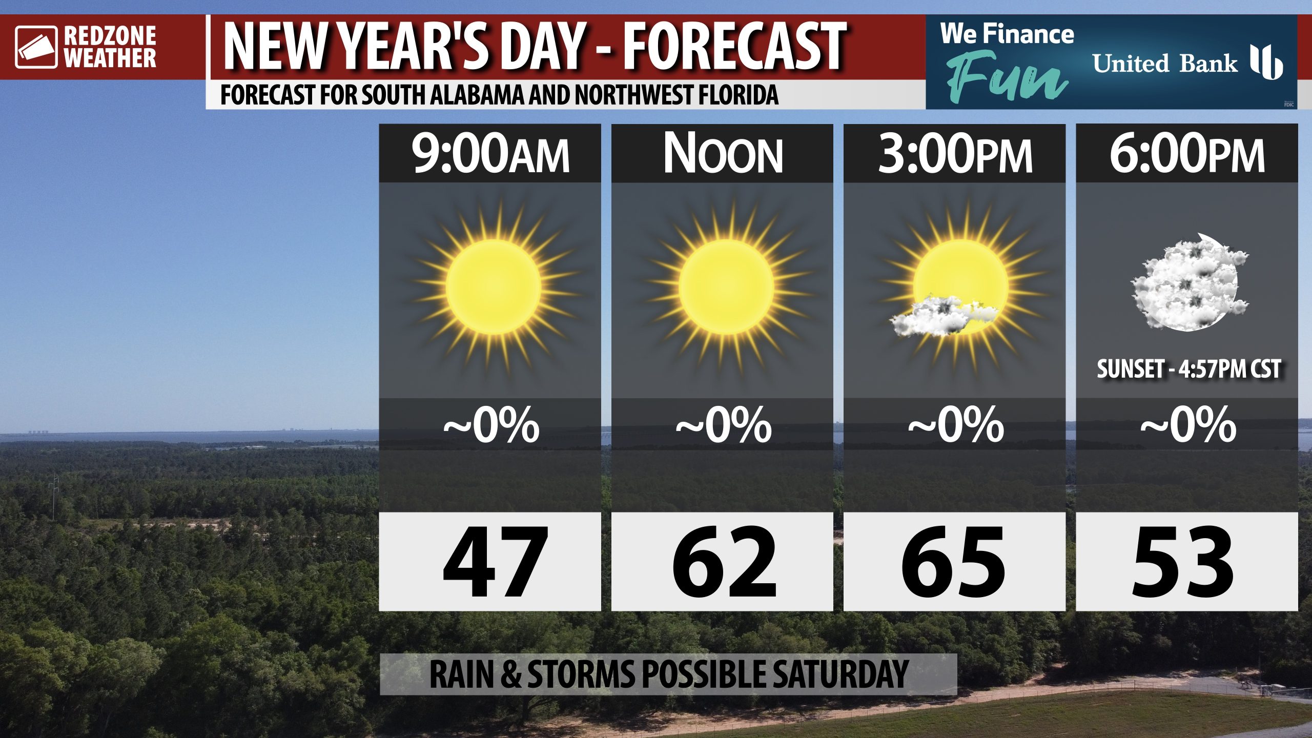
MAINLY SUNNY FOR NEW YEAR’S DAY… Happy New Year! I hope your 2026 is your best year yet.
Mostly sunny skies this morning will give way to increasingly cloudy skies this evening after sunset. Afternoon highs will be in the mid 60s.
Have a wonderful New Year’s Day!

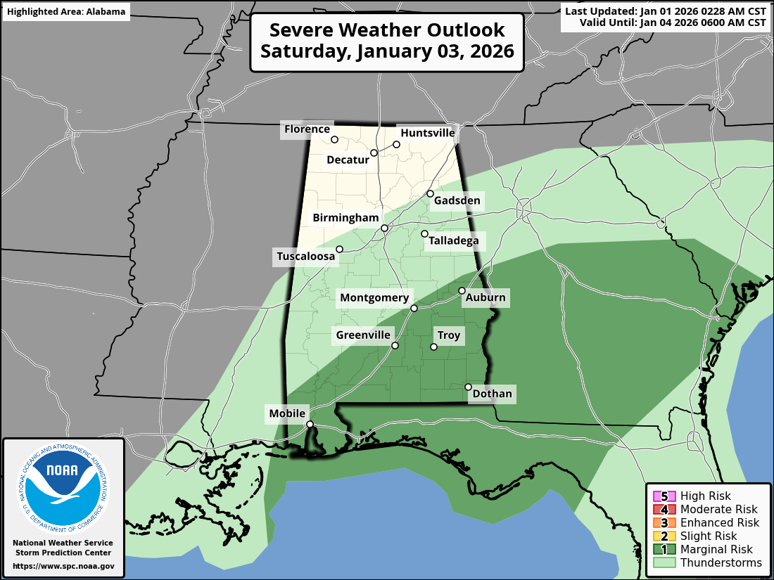
LOW-END SEVERE WEATHER RISK SATURDAY… Saturday may feature a few strong to marginally severe thunderstorms across parts of south Alabama, northwest Florida, the Florida Panhandle region, and much of central and southern Georgia.
The Storm Prediction Center has included these areas in a low-end, Level 1 (out of 5) severe weather risk zone. Gusty winds will probably be the main concern. A few tornadoes and large hail may also become possible in the strongest of the storms.

We’re near 39° at 9PM in many communities across the region. Temperatures will be around 34° at midnight. 🥶
— Spinks Megginson (@rzweather) January 1, 2026

Chilly #NewYearsEve moonrise earlier this evening. 🌔 @NWSMobile @spann @AlabamaWXNet @rzweather @KNBHwx @ThomasGeboyWX @WKRGEd @textamet #ALwx pic.twitter.com/gQFdJKE5uS
— 🎄𝙱𝚛𝚒𝚝𝚝𝚊𝚗𝚢 𝙶𝚒𝚕𝚋𝚎𝚛𝚝❄️ (@britttg_94) January 1, 2026
