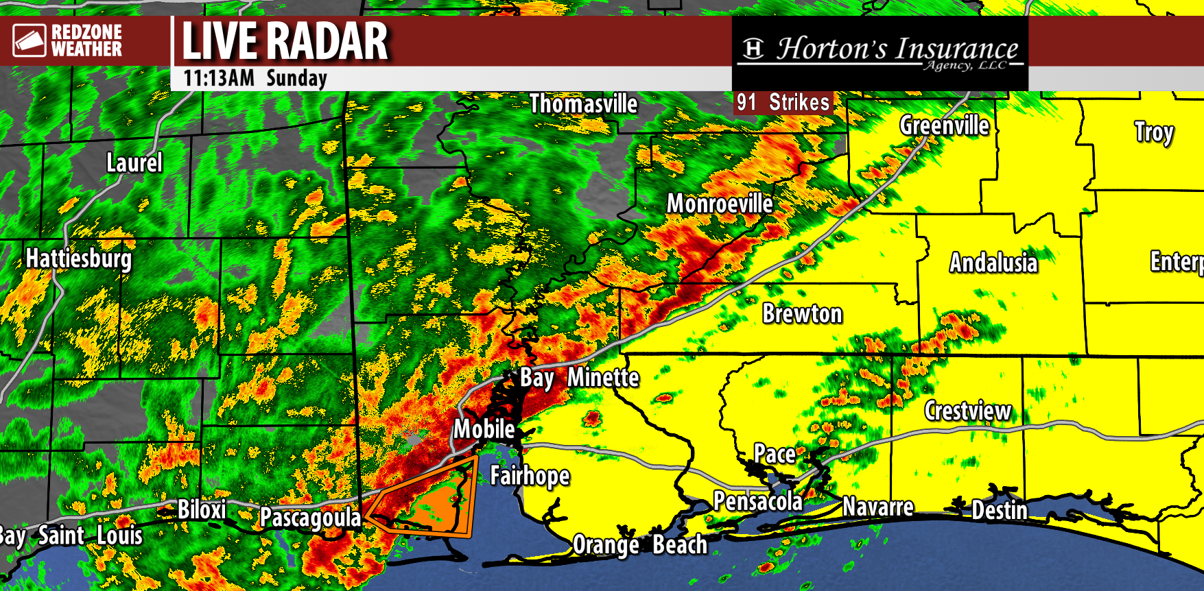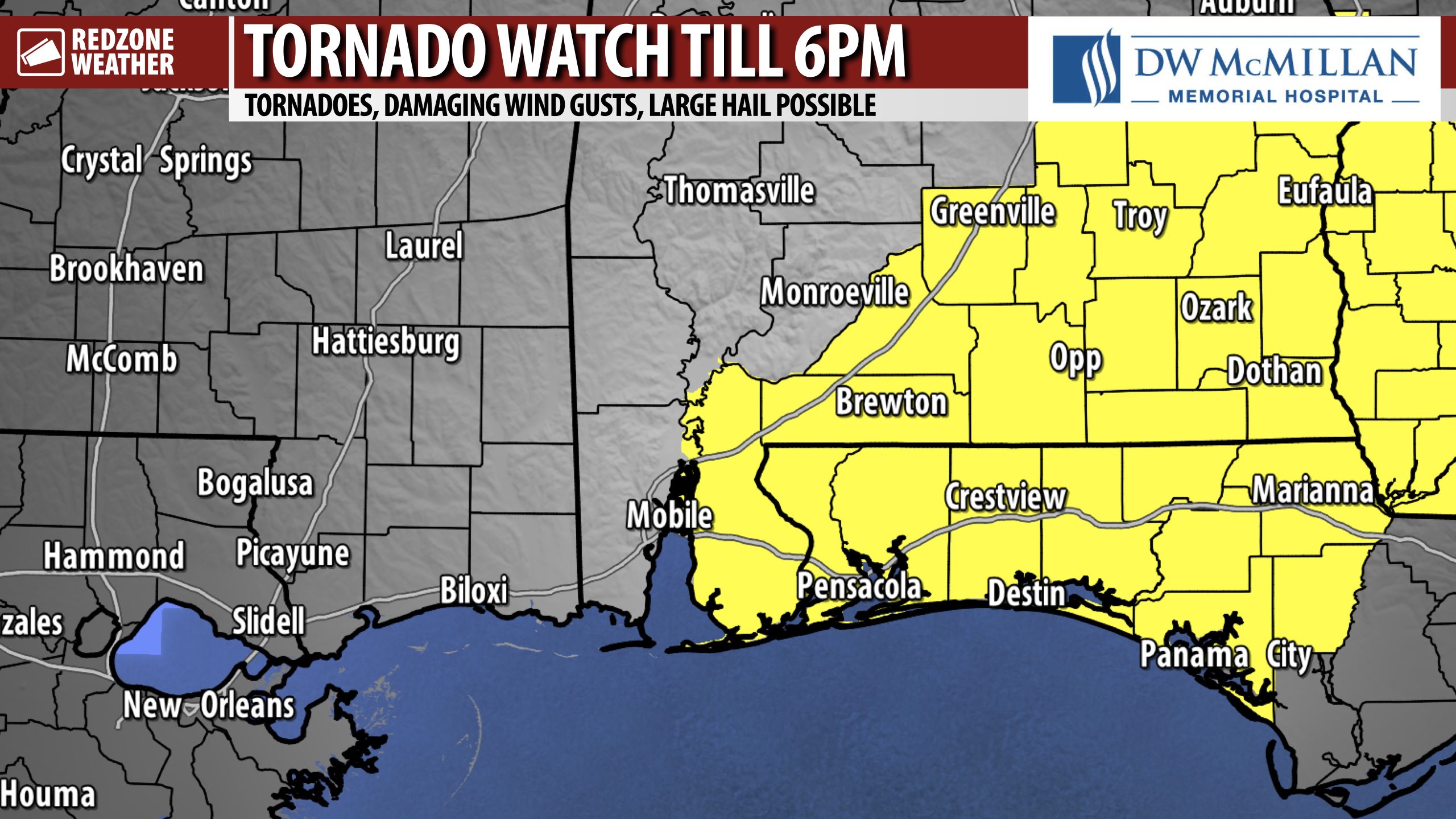
TORNADO WATCH IN EFFECT… Tornado Watch till 6PM for Baldwin, Escambia (AL), Conecuh, Butler, Covington, Escambia (FL), Santa Rosa, Okaloosa counties and points east in SE AL and the Florida Panhandle. This includes Daphne, Spanish Fort, Fairhope, Bay Minette, Foley, Sumemrdale, Gulf Shores, Orange Beach, Elberta, Gateswood, Seminole, Lillian, Pensacola, Century, Walnut Hill, McDavid, Warrington, Perdido Key, Bratt, Gonzalez, Cantonment, Brewton, Atmore, Flomaton, Poarch, Huxford, Appleton, Nokomis, Damascus, Evergreen, Lenox, Belleville, Owassa, Johnsonville, Castleberry, Greenville, Georgiana, McKenzie, Oaky Streak, Forest Home, Andalusia, Opp, Florala, Red Level, Straughn, Rose Hill, Milton, Pace, Jay, Chumuckla, Allentown, Navarre, Gulf Breeze, Midway (FL), Tiger Point, Holt, Harold, Baker, Milligan, Crestview, Destin, Niceville, Fort Walton Beach and points west in southeast Alabama, the Florida Panhandle, and into southwest Georgia.
Be ready for possible warnings!