8:55PM November 8, 2025
Birds enjoying a gorgeous evening and stunning sunset at Floridatown Park. @rzweather pic.twitter.com/gKqtVKuswC
— Dan Mitchell (@TheDanMitchell) November 9, 2025

Birds enjoying a gorgeous evening and stunning sunset at Floridatown Park. @rzweather pic.twitter.com/gKqtVKuswC
— Dan Mitchell (@TheDanMitchell) November 9, 2025
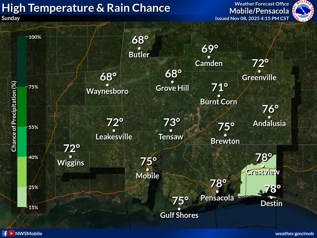
COLDER AIR ARRIVES THIS EVENING… We transition from warm weather to COLD temperatures tonight after the passage of a cold front.
Isolated showers will be possible over the next few hours.
High temperatures will range from the upper 60s in west Alabama to near 80° closer to the NW FL beaches.
Have a nice Sunday!

Isolated showers will be possible toward daybreak across south Alabama and northwest Florida. I expect MOST communities to remain dry but a few brief raindrops can't be ruled out.
— Spinks Megginson (@rzweather) November 9, 2025

Severe Thunderstorm Warning for Gateswood, Elsanor, Barrineau Park in parts of Baldwin County, AL valid until 9AM.
Small part of Escambia County, FL also involved in this warning just southwest of Walnut Hill. pic.twitter.com/BQn1uhP08w
— Spinks Megginson (@rzweather) November 9, 2025

Remember that broadly rotating storm in northern Butler County, AL a few hours ago?
This is the aerial view. No reports of damage, thankfully. https://t.co/Mgc92OEjPO
— Spinks Megginson (@rzweather) November 8, 2025

Isolated showers and perhaps a thunderstorm or two will be possible overnight. Storms will likely remain below severe limits locally. pic.twitter.com/U1KgrWMygi
— Spinks Megginson (@rzweather) November 8, 2025

On Tuesday morning, parts of the Southeast U.S. will be about as cold as Nuuk, Greenland — near the edge of the Arctic Circle.
It will be warmer in St. John's, Newfoundland, than in parts of northern Florida. pic.twitter.com/SU1TNvQAdx
— Ben Noll (@BenNollWeather) November 7, 2025
