1:11PM June 19, 2026
Severe Thunderstorm Warning for Geneva County in AL until 2:00pm.
— Spinks Megginson (@rzweather) June 19, 2026

Severe Thunderstorm Warning for Geneva County in AL until 2:00pm.
— Spinks Megginson (@rzweather) June 19, 2026
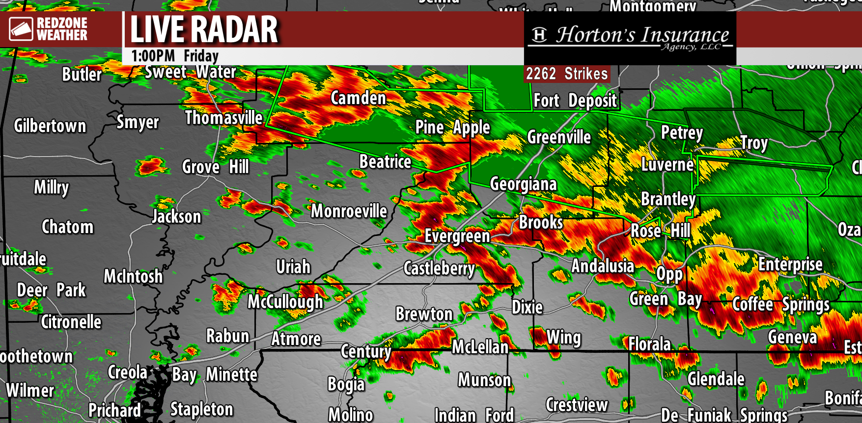
STRONG STORMS WITH INTENSE LIGHTNING MOVING SOUTHEAST… Numerous thunderstorms have developed across south Alabama and interior stretches of northwest Florida this afternoon. These storms are just under severe limits in most cases, for now. The strongest storms locally are happening near Andalusia, Straughn, Opp, Babbie, and Gantt in Covington County. These storms are capable of producing 40-50 mph wind gusts while moving southeast toward Libertyville and Onycha.
Strong storms have also developed near Evergreen, Belleville, Lyeffion and Johnsonville.
Heads up also if you’re near Jay, Dixonville, Thomasville, Gosport, McCullough, Huxford, and Wing. Spotty storms are strengthening near these communities as well.
WHAT TO EXPECT – NEXT FEW HOURS… Scattered thunderstorms will likely continue to increase in coverage and intensity across the region. This, unfortunately, means that widespread flash flooding may quickly become a concern today, mainly because the ground is so incredibly saturated after the 6-12″ rain totals yesterday. In addition to the significant flash flooding concerns, pockets of damaging wind gusts and a brief tornado or two will be possible in the strongest of the storms.
We encourage everyone to have multiple ways to hear warnings into this evening. PLEASE heed the flash flood warnings today and do NOT attempt to drive through a water-covered roadway!
I will have radar updates posted throughout the afternoon and evening in the RedZone Weather app.

Strong thunderstorms are moving into Andalusia, Opp, Straughn, and Eoda from the north. Also seeing strong storms near Beatrice, Old Texas, Pine Hill, Thomasville, and Camden.
There have been intermittent signs that some of these storms could become severe. Damaging wind gusts https://t.co/ppjn2uE7pH
— Spinks Megginson (@rzweather) June 19, 2026

Scattered strong to severe thunderstorms will be possible over the next 6-8 hours across south Alabama and northwest Florida.
Greatest risk happens north of I-10 across inland areas.
Main concerns today: Damaging wind gusts, flash flooding, and severe and prolific https://t.co/n9peBfTmQB
— Spinks Megginson (@rzweather) June 19, 2026

Strong thunderstorms in Wilcox and Butler counties are slowly moving east. LOTS of lightning with these storms.
The overall severe weather risk remains LOW but not entirely zero over the next several hours. Have a way to hear warnings!
Flash Flood Warning just posted for https://t.co/DP5XAoIWrO
— Spinks Megginson (@rzweather) June 19, 2026

RT @NWSMobile: A Heat Advisory is now in effect for portions of extreme southeast MS, extreme southwest AL, and coastal portions of the wes…
— Spinks Megginson (@rzweather) June 19, 2026

Flash Flood Warning for Butler and Monroe County in AL until 4:00pm Friday.
— Spinks Megginson (@rzweather) June 19, 2026
