8:15AM October 27, 2025
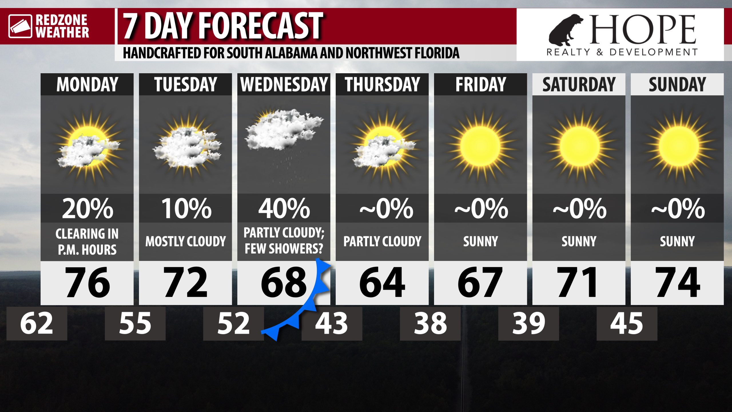
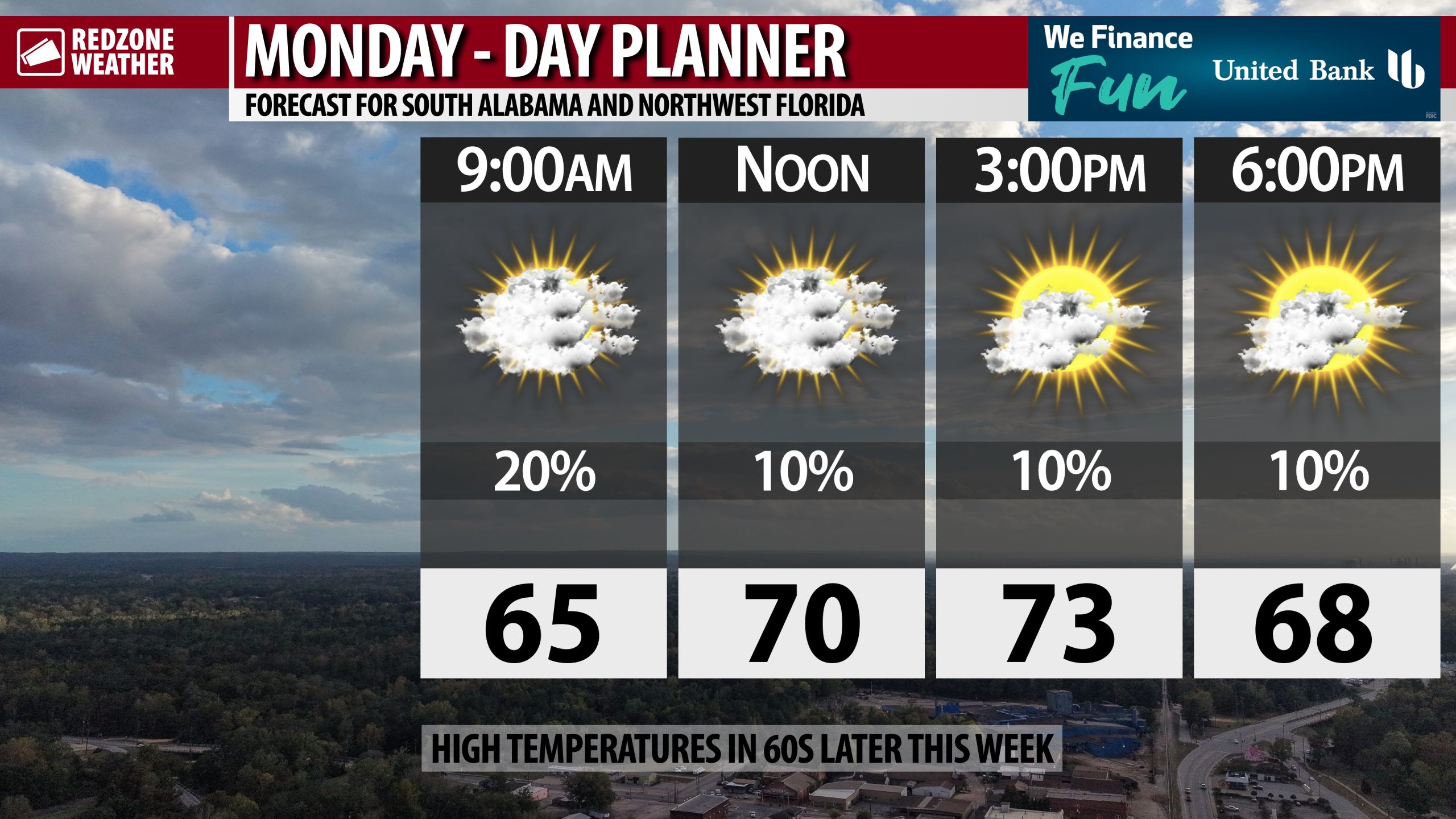
RAIN POSSIBLE TODAY AND ON WEDNESDAY… A few showers are possible today ahead of another batch of showers ahead of a cold front on Wednesday.
Dry, colder air arrives Thursday. Overnight lows will likely be in the 30s in many communities by Friday morning!