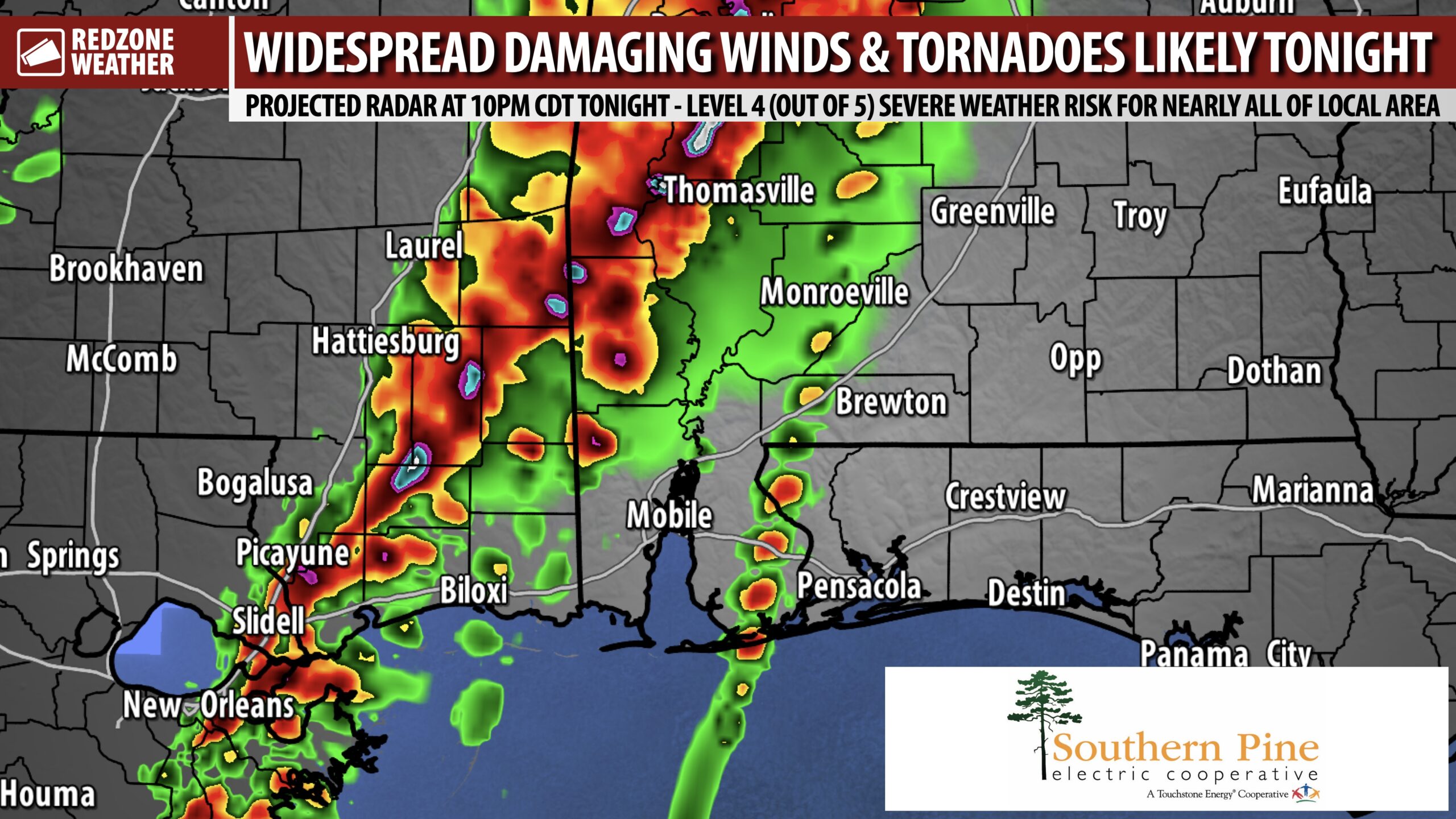
FORECAST ON TRACK: SEVERE STORMS LIKELY TONIGHT; TORNADOES & DAMAGING WINDS… No major forecast changes are needed, unfortunately, meaning we continue to look at the potential for strong tornadoes and a widespread damaging wind event across south Alabama and northwest Florida tonight. Pressure gradient winds out ahead of the storms are causing occasional wind gusts of 40-50 mph across the region this afternoon. A High Wind Warning is now in effect for all parts of Mobile, Washington, and Choctaw counties in west Alabama along with all of southeast Mississippi. A Wind Advisory continues today and into tonight due to these ongoing, high pressure gradient winds out ahead of the storms.
Again, no changes needed. The forecast is on track. Severe storms will become likely this evening after 6PM. Supercell storms may develop out ahead of the main line of storms that could produce strong, long-tracked tornadoes. As always, we will go into uninterrupted, live video coverage when/if tornado warnings are needed for the local area. The attached graphic highlights the projected radar off the HRRR model tonight at 10PM.
SEVERE WEATHER TIMING – TONIGHT INTO THURSDAY… This evening into early Thursday morning remains the primary severe weather risk will likely set up across south Alabama and northwest Florida. 6PM this evening to 6AM Thursday is the 12 hour window when severe weather threat will likely maximize across our area. 9PM to 3AM looks to be the 6 hour “core risk” window for local areas. Again, please have a way to get warnings overnight. We all need a device that can wake us up if a tornado warning is needed locally.
LEVEL 4 (OUT OF 5) SEVERE WEATHER RISK TONIGHT… The Storm Prediction Center continues to include nearly all of our local area in southwest Alabama and northwest Florida in their Level 4 (out of 5) significant severe weather risk zone. A Level 4 (out of 5) risk means that long-lasting, intense thunderstorms will be possible. The risk of significant or strong tornadoes is elevated. The risk of damaging straight line winds is high. Power outages could become numerous if a severe line of storms starts knocking down trees across the region.
SIGNIFICANT TORNADO RISK TODAY TO OUR WEST AND TONIGHT LOCALLY… Thunderstorms have developed across Louisiana and Mississippi first today. These storms will gradually move east throughout the day. Storms will move into west-central Alabama first this evening and pose a risk of fast-moving, quick-hitting, strong (EF2+) tornadoes. These tornadoes may be moving at 50-60 mph in some cases. Very quick moving storms today into tonight. The significant tornado risk will increase tonight across southwest Alabama and northwest Florida. Please have a way to get warnings throughout the night!
INTENSE, DAMAGING WIND EVENT POSSIBLE… I continue to be quite concerned about the potential for damaging straight line winds that could be widespread across the local area. Power outages will quickly become possible tonight as an intense line of strong to severe thunderstorms moves in from the west, if storms start knocking down trees. The likelihood of power outages is a bit higher with this severe weather risk compared to the last few events. We encourage everyone to charge your devices (phone, tablets, iPads, etc.) NOW before we get to this severe weather potential in the overnight hours.
ANOTHER ROUND OF SEVERE STORMS POSSIBLE NEXT WEEK… I’m aware this is the last thing you want to hear as we stare down a major severe weather potential today into tonight. ANOTHER, separate severe weather risk may set up on Tuesday of the upcoming week (April 5). The local National Weather Service office in Mobile states it best in their forecast discussion: “Model guidance continues to show the potential for another possibly strong storm system over the Southeast next Tuesday; however, there remains disagreement between model solutions. Because of this and since the event is far out in time, it is difficult to discuss any specifics at this point. We will continue to monitor trends and how this system evolves in the coming days. Please stay tuned and weather aware, as this time of year is prime time for severe weather in the South.”
TORNADO WARNING POLICY… Any time there is an active tornado warning in effect for southwest Alabama or northwest Florida, we provide uninterrupted, live video coverage on Facebook Live and in the RedZone Weather app. Our detailed coverage commitment is outlined at redzoneweather.com/coverage. We are proud to cover all parts of Escambia (AL), Covington, Monroe, Conecuh, Baldwin, Mobile, Clarke, Washington, Butler, Escambia (FL), Santa Rosa, and Okaloosa counties. If you live in any locale in those counties, be sure to tune into our coverage whenever there is an active tornado warning!
SET UP APP ALERTS… We send quite a bit of Low-Level Alerts in our RedZone Weather app. The app is totally free for you! redzoneweather.com/app is the link where you see the download links to your respective app store for iOS and for Android devices. Once you have the app downloaded to your smartphone or tablet device, be sure to visit the Alerts tab to customize the alerts you would like to receive straight from me.
I will have ongoing updates posted throughout the afternoon and evening in the RedZone Weather app. We will go into uninterrupted live video coverage later this evening if/when tornado warnings are required for our local area. Have a nice Wednesday evening and please stay safe tonight!
