
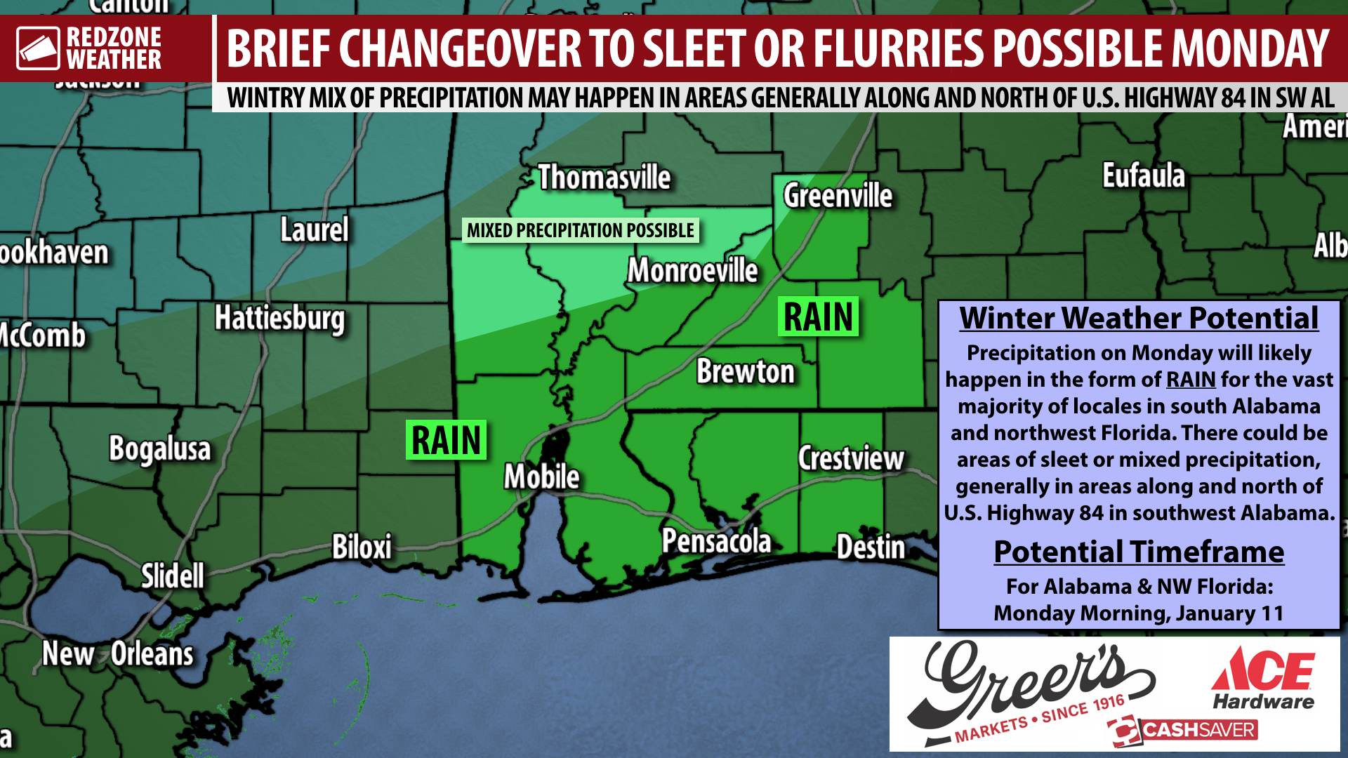
WINTRY MIX POSSIBLE MONDAY ACROSS SOME INLAND AREAS; RAIN FOR MOST LOCALES… Rain will be likely at times on Monday. New trends from the major weather models support the potential for a few flurries or sleet mixing in with the rain on Monday morning across some areas of southwest Alabama, mainly inland in areas along and north of U.S. Highway 84. Right now, it appears the main chance for sleet and/or mixed precipitation will happen in parts of Clarke, Washington, Choctaw, Wilcox, and maybe even northern Monroe counties. Accumulation appears highly unlikely since temperatures will be rising on Monday morning fairly quickly. We note a big chunk of our area, including all communities near the coast will just have a cold rain on Monday.
SNOW POSSIBLE WELL TO OUR NORTHWEST… Snow seems much more likely to happen in parts of central Mississippi and the northwestern corner of Alabama. If you’re looking for snow that could have at least some chance of accumulating, those are the zones to look toward. Accumulating snow and sleet does not seem as likely anywhere in Alabama along and south of U.S. 80 in the central part of the state.
GREATEST CHANCE OF WINTRY MIX ACROSS CLARKE, WASHINGTON, MONROE COUNTIES… Locally, if we see any mixed precipitation, sleet, or flurries, that chance is maxed out across parts of Clarke, Washington, and Monroe counties. This means communities like Thomasville, Coffeeville, Jackson, Grove Hill, Millry, Chatom, and perhaps even Beatrice and Monroeville could see some sleet or flurries mixed in with the rain.
COLD SATURDAY; SUNNY BY THE AFTERNOON… Before we get to the rain on Monday, increasingly sunny skies are expected on both Saturday and Sunday. I expect clouds to be mostly gone to our east by Saturday afternoon. High temperatures won’t recover that much on Saturday and most spots will end up only in the upper-40s. Overnight lows tonight and on Saturday night will be below freezing, especially in communities farther inland.
APP… If you haven’t already, be sure to download the free RedZone Weather app to keep up with all the latest information on the world of weather in south Alabama and northwest Florida. redzoneweather.com/app is the link for the free download. Once you have the app downloaded to your iOS or Android device, be sure to visit the Alerts tab (lower right corner) and tap the large, yellow Alert Settings button to customize the alerts you would like to receive straight from me.
I will have your next full forecast discussion detailing the very latest information posted by 7:15AM tomorrow morning. Have a nice Friday evening!