
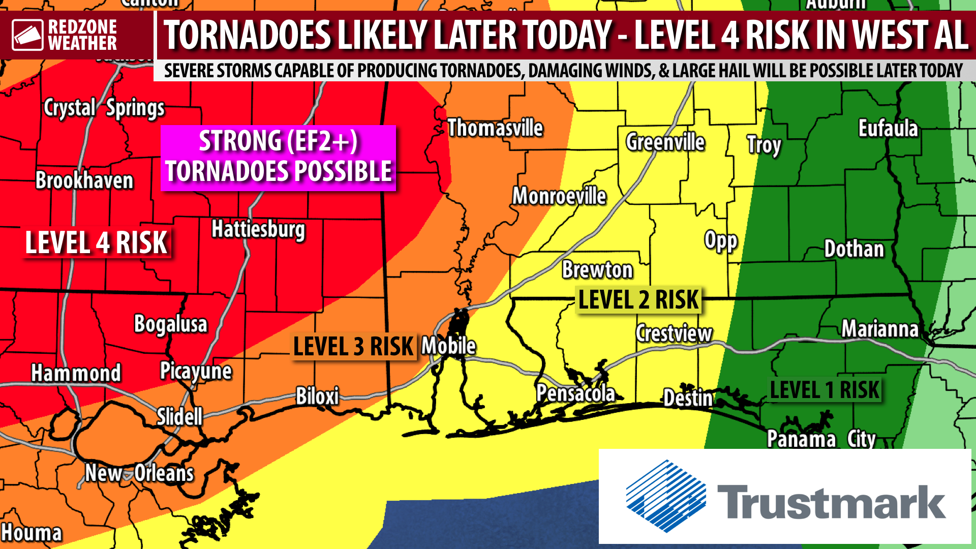
OUTLOOK UPGRADE FOR WEST ALABAMA; TORNADO RISK LATER TODAY… Parts of west Alabama are now involved in the Level 4 (out of 5) significant severe weather risk zone valid for later today into tonight. This is the updated convective outlook, valid as of 5AM on Tuesday, March 22, 2022. The Storm Prediction Center has also expanded the Level 3 risk zone to include a bit more of our local area in southwest Alabama. Regardless of which specific risk zone or color your location is involved in, it should be emphasized we ALL have a severe weather risk today. Tornadoes, including a few strong and/or long-tracked tornadoes, damaging wind gusts, large hail, and flash flooding are the main concerns.
Noon to 4PM is when a few tornadoes and large hail may first happen across west Alabama, then from 9PM tonight to 6AM on Wednesday morning, we all have a risk of damaging winds, tornadoes, hail, and flash flooding as a complex of storms moves from west to east across our area.
I am in the process of working up the latest forecast details. I will have your next full forecast video posted by 7AM. Be sure to join me then for the very latest information. If and when we have tornado warnings today, we will go into our Facebook Live coverage. Have a nice Tuesday and please stay safe!